5 walks exploring Highland Perthshire waterfalls

Planning a trip to Highland Perthshire? We’ve put together five amazing walks that let you explore some of Perthshire’s most spectacular waterfalls.
Highland Perthshire, nestled in the heart of Scotland, is a treasure trove of waterfalls just waiting to be explored.
However, the beauty of Perthshire’s waterfalls lies not only in their raw, natural power but in the beauty of the surrounding forests and landscapes, all of which can be enjoyed on various length walks.
Most walks are circular routes on well-maintained paths making them accessible for all walking levels.
In this post, we share 5 of Perthshire’s stunning waterfall walks that you can enjoy any time of year!
Black Linn Falls and the Falls of the Braan
Walk overview
- Length: 5 miles
- Difficulty: Easy
- Trail type: Woodland trail
- Elevation: 525 feet
- Time: 2 – 3 hours
- Best time to visit: All year round
- Start location: Hermitage car park
- Get there by public transport: Trains run from Perth to Dunkeld and Birnam several times a day.
- Get there by car: Take the A9 north from Perth and turn off at the exit for The Hermitage just past Dunkeld.
Located on the outskirts of the quaint village of Dunkeld, the Black Linn Falls and Falls of the Braan can be visited as part of the Hermitage walk.
These Hermitage woodlands were once the private pleasure grounds for the 18th-century Dukes of Atholl. It’s now one of Perthshire’s most charming and sought-after walks.
Despite its popularity, it’s still possible to enjoy this walk without being too crowded. Visiting later in the day or during the quieter seasons will mean fewer folk visiting the area.
Most people start the walk at the Hermitage car park, but it can also be started from Dunkeld town centre or train station which are only 1.5 miles away.
As you stroll through this captivating forest, you’ll be surrounded by magnificent Douglas firs that border the River Braan.
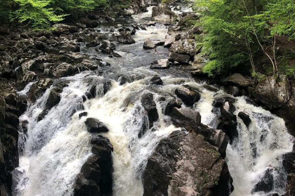
Your first stop along the trail is the dramatic Black Linn Falls, which can be viewed from the enchanting folly, known as Ossian’s Hall. This stone pavilion, constructed in 1757, adds a touch of romance to the woodland and is a favourite spot for couples to exchange vows.
However, the purpose of the folly was to provide a spectacular viewpoint over the Black Linn Falls, and it certainly doesn’t disappoint. As you walk out onto the balcony you’ll be able to view the falls close up as they tumble over the huge rocks.
After Ossian’s Hall, the walk continues along the river, ultimately leading you to the Rumbling Bridge and the Falls of Braan. These striking falls have a more rugged charm. You can view them from the bridge or various vantage points along the water’s edge.
This walk is great to do any time of year, thanks to its easily accessible and well-maintained trails, but it’s especially spectacular in the autumn when the woodlands burst into a riot of colours.
Hermitage and River Braan map
Falls of Moness – Birks of Aberfeldy Walk
Walk overview
- Length: 2.7 miles
- Difficulty: Easy
- Trail type: Woodland trail
- Elevation: 550 feet
- Time: 1.5 – 2 hours
- Best time to visit: All year round
- Start location: Birks of Aberfeldy car park or Aberfeldy town centre
- Get there by public transport: Aberfeldy is served by the 23 or 27 bus, which runs from Perth and through Dunkeld. Perth and Dunkeld both have train stations with services to from Glasgow, Edinburgh, and Inverness.
- Get there by car: Take the A9 north from Perth and turn off at the exit for Aberfeldy.
The Falls of Moness, located on the outskirts of Aberfeldy, is a spectacular 150-meter waterfall and a series of smaller falls that flow into Moness Burn.
The circular walk is aptly named The Birks of Aberfeldy after Scotland’s much-loved poet Robert Burns, who wrote song lyrics about the Birks of Aberfeldy back in the 1700s.
You can start the walk from Aberfeldy town centre or at the Birks car park. To start, follow the trail from the car park and take the first bridge on the left.
Tip: although this is a circular walk, I would recommend crossing the bridge first and following the path on the east side of the burn as you get the best viewpoints approaching each of the falls as you make your way up to the top.
Along the first section of the walk, you’ll encounter two wonderful tributes to Robert Burns. The first is the Burns statue which portrays Burns perching on the edge of the stream reading one of his poems. The second is Burns’s cave, which is supposedly where he sat to write the Birks of Aberfeldy.
As you continue walking up this side of the gorge, you’ll pass lots of beautiful cascading waterfalls which you can easily view from the wooden walkways that form part of the trail.
At the top there is an excellent viewpoint that looks out across to the main waterfall as is plummets into the abyss.
Continue following the path that will lead you to the other side and to a wooden bridge where you can walk across the top of the waterfall itself. Viewing the waterfall from above is particularly impressive when there’s been a lot of rain and the stream is bursting. The force of the water is so strong that it can be quite breathtaking!
There are two ways to return down the hill. After the bridge either turn right and follow the woodland path down the west side of the gorge. Or turn left and continue walking uphill for a few minutes, and follow the trail out onto the road, which will lead you ]down to the bottom of the hill where you’ll see the car park. This is a slightly longer way back, but there are great views of Aberfeldy town and Schiehallion in the distance.
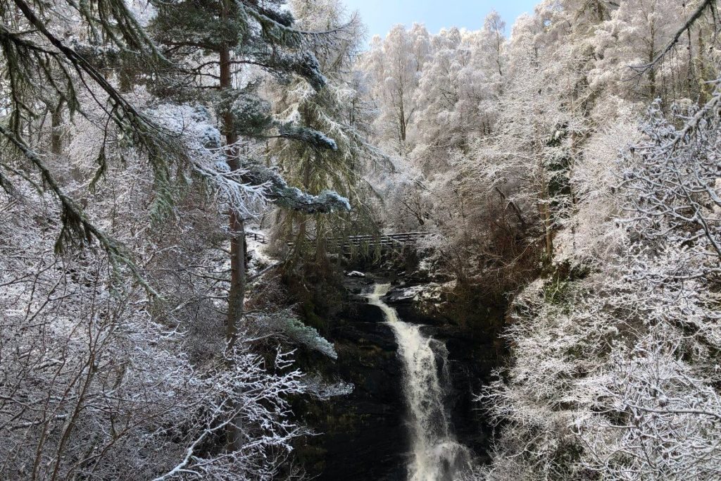
Enjoy this beautiful walk any time of year. But one of my favourite seasons is in winter, when there’s been a fresh dusting of snow and the woodland becomes a magical winter wonderland.
Birks of Aberfeldy map
Falls of Bruar
Walk overview
- Length: 1.5 miles
- Difficulty: Moderate
- Trail type: Woodland trail
- Elevation: Approx 400 ft
- Time: 1 hour
- Best time to visit: All year round
- Start location: House of Bruar car park
- Get there by Public transport: Blair Atholl train station is 3.7 miles away from the start of the walk. The number 87 bus towards Struan picks up at the Atholl Arms in Blair Atholl and drops off at the House of Bruar.
- Get there by car: Take the A9 north from Perth and turn off at the House of Bruar exit.
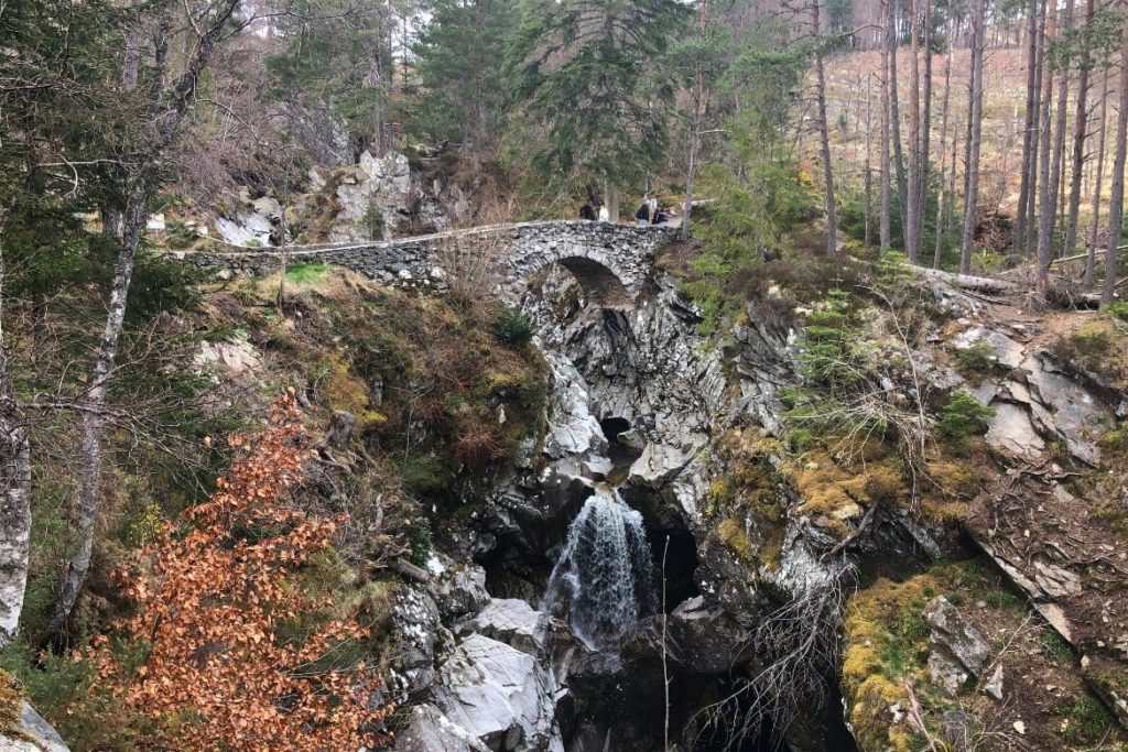
The Falls of Bruar is a run of captivating waterfalls that cascade through a narrow gorge just outside of Blair Atholl.
The woodland walk follows a short but picturesque trail that runs alongside the course of the Bruar Water as it tumbles dramatically through the gorge.
In total, the series of waterfalls drop an impressive 60m (almost 200ft)!
The circular walk starts next to the House of Bruar department store and follows a woodland path that runs on the right-hand side of the gorge.
There are so many great viewpoints along this walk, some to view the falls themselves, and others that take in the stunning surrounding landscape and hills.
The walk is especially pretty in autumn when the trees turn vibrant colors, or after heavy rainfall when the falls are at their fullest.
Falls of Bruar walking map
Black Spout Waterfall

Walk overview
- Length: 3 miles
- Difficulty: Easy
- Trail type: Woodland trail
- Elevation: Approx 400 ft
- Time: 1.5 hours
- Best time to visit: All year round
- Start location: Black Spout Woods car park
- Get there by public transport: Pitlochry train station is 1.2 miles away from the start of the walk. Bus and coach services run to Pitlochry from many locations across Scotland.
- Get there by car: Take the A9 north from Perth and turn off at the exit for Pitlochry.
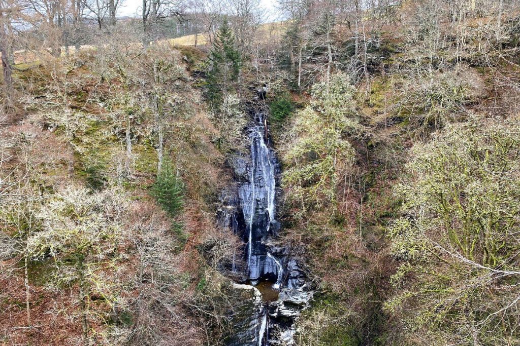
The Black Spout waterfall walk is a 3-mile loop that can be started from the center of Pitlochry town, or at the Black Spout Wood car park.
The 190-foot waterfall takes its name from the beautiful surrounding Black Spout woods and forms part of Eradour Burn.
Starting from the car park follow the woodland path and signs to the Black Spout Falls. At the top of the hill, a wooden viewing platform looks across to the falls. This is undoubtedly the best spot to view the waterfall as it plunges into the gorge.
You can also make your way down to the top of the falls where you can explore the pools. Just follow the trail that forks off to the right after the viewing platform, but take care walking down this path as it can be slippy and steep in places.
The rest of the walk eventually leads you out of the woods where you’ll have wonderful views of Ben Vrackie and Pitlochry’s surrounding hills. It then passes Eradour Distillery, Scotland’s smallest distillery, and loops back to the start.
This walk is a great addition to any itinerary when visiting Pitlochry. Also extend it into a longer walk, such as the 9-mile Pitlochry Four Waters walk.
Black Spout Waterfall map
Falls of Acharn Walk
Walk overview
- Length: 1 mile
- Difficulty: Easy
- Trail type: Gravel and woodland trail
- Elevation: Approx 325 ft
- Time: Less than 1 hour
- Best time to visit: All year round
- Start location: Acharn village
- Get there by public transport: A bus service runs from Aberfeldy and stops near where
- Get there by car: Take the A9 north from Perth and turn off at the exit for Aberfeldy. Continue driving through Aberfeldy towards Kenmore and continue on for Acharn.
The Falls of Acharn are located on the edge of Loch Tay in the hamlet of Acharn near picturesque Kenmore. Measuring 80 feet, the spectacular waterfall plummets into the gorge before flowing the water out into the Loch.
One of the highlights of the walk is the Hermit’s Grotto. The mysterious folly, built in the 1700s, is a stone cave that leads walkers into its dark depths and then out onto the viewpoint for the falls.
Further up on the walk, there are some additional viewing platforms and wooden walkways which are great spots to view the upper falls and pools.
Although this is a circular walk, the trail on the east side of the gorge can be narrow and uneven on foot, so another option (and much easier) is to retrace your steps down the farm track you walked up.
The Acharn Falls walk can also be extended on two longer walks. The first is a 6.5-mile circular Acharn Burn route that starts in Acharn but continues up into the hills. The second is an 8-mile circular route starting in nearby Kenmore, that includes Kenmore Hill.
Acharn Falls map
So there you have it. Five great waterfall walks that can be done any time of year when you visit Highland Perthshire!
The beauty of each of these walks is that you can make them longer if you want to explore further afield, or stick to shorter routes if you’re short on time.